

LOCAL WATERWAYS
- 25-09-2019
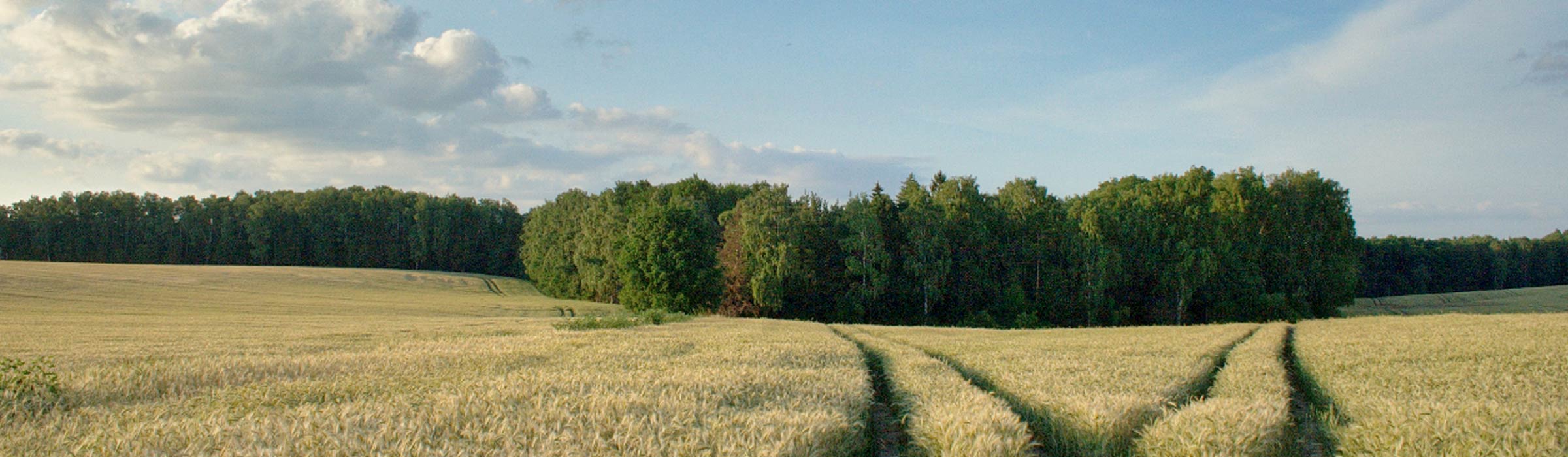
There are many rivers and streams in the Nowe Miasto Lubawskie commune. Six of them are large enough to be followed by canoe trips. Most of these rivers are quite wild. Many bends, branches and shrubs hanging low above the water surface and other similar attractions, will give canoeists a lot of unforgettable impressions and sometimes a portion of adrenaline. The navigable rivers are Drwęca, Wel, Struga, Skarlanka and Kakaj.
Waterway of Drwęca river
The Drwęca route is often extended by another 10 km section of the Vistula (Wisła) river, leading water sports enthusiasts to the center of Toruń. Numerous kayak guides provide detailed descriptions of the entire trail. It is worth mentioning here that Drwęca affects the area of the Nowe Miasto Lubawskie commune at 68.5 km of its course, near the village of Pustki. Drwęca leaves the commune after 9.5 km. on 78 km of its course, on the border of the village of Mszanowo and Nowe Miasto Lubawskie. In the commune there is one of the convenient places to start rafting on Drwęca river near the road bridge.
Waterway of Wel river
The Wel River is 95.8 km long and it is one of the most attractive canoeing routes in the lake districts. The float from Lake Dąbrowa Wielka has 9 other lakes on its trail. However, the main attraction of the trail is a number of sections of a mountain nature, where the river reaches a relatively large decline.
The Wel river divides into two branches. The left called Bałwanka flows into the commune about 0.5 km below the bridge on the road Mroczenko-Grodziczno. Among the meadows and rushes surrounded by the forest, Bałwanka flows after approx. 1.5 km to Lake Fabryczny, also called Tylicki or Przebocz. An outflow is difficult to find in the northeastern part of the commune. Soon the river joins the right, strongly meandering, branch of the Wel River, which flows through the Grodziczno Commune. After passing the village of Kuligi, below the village of Jakubkowo, Wel flows back into the Nowe Miasto Lubawskie commune. Initially through the forest, and then among the buildings of the village of Kaczek. Wel flows to Bratian, where it flows into Drwęca.
Waterway of Struga river
The small Struga also called Struga Radomno or Ruda flows out of a wetland located in the forests on the south from Iława. It is about 15.7 km long and is navigable from Łąckie lake. Due to the difficult access to this lake, it is most convenient to start rafting in Radomno. 0.0 we launch a canoe on the lake Radomno. It has a very varied shape because it is Surrounded by forests from the north and arable fields from the south. To make a trip to Łąckie lake you need to swim into the northwest bay. The river flows into the lake at the northeastern edge of the bay. 2.3 A wide swamp among the reeds leads us to the lazy river current. Almost all the time the trail leads among the reeds, surrounded by forests and in direct contact with almost unspoiled nature. 6.5 We reach Łąckie Lake. After visiting the lake surrounded by forests, we can return along the same route. On the way back, if the high water level allows it, you can take a trip to Czerwone Lake. The lake is shallow, marshy, with inaccessible shores, but surrounded by forest.0.0 After visiting the Radomno Lake (and possibly Łąckie Lake), you can continue your trip down the Drwęca River. Narrow outflow of Radomno lake is located in the southwestern part of the lake, in a cove overgrown with rushes. The river current is clear and fast. After passing a few obstacles (valve, piles, stones under the road bridge) the current weakens and the stream flows in a wide. Behind the next road bridge, the river turns east and flows along the railway embankment, up to the next bridge, under the road from Iława to Nowe Miasto Lubawskie. 5.3 At the pine forest, another turn, first sharp left, and at the end of the forest right. Struga flows through the village of Ruda. 8.6 After passing the rocky rapids, the river flows into Drwęca. Then you can continue rafting down Drwęca to Toruń or through the picturesque Brodnickie Lake District.
Waterway of Skarlanka
The river Skarlanka is 37 km long and it is the main watercourse of the picturesque Brodnickie Lake District. It also creates a picturesque canoe trail, which starts at Skarliński lake. 0.0 You can conveniently launch in several places: at the eastern edge of the lake, 1.5 km from this place, directly from the highway, on the northern shore, at the western edge of the lake, where the Nowe Miasto Lubawskie - Biskupiec road reaches Wawrowice directly to the shore ( at the outflow of Skarlanka). Skarlińskie Lake is quite picturesque. After sailing to the western end of the lake, it changes radically. 7.5 The outflow of Skarlanka from the lake is located in the overgrown west edge. It is necessary to move the canoe through the road. 8.2 The Biedaszek mill necessitates another move. We sail all the time through a pine forest, then an alder forest, avoiding the next few obstacles. 13.2 Wielkie Partęczyny Lake on the edge of the Brodnicki Landscape Park. Then you can continue your journey through the Dębno, Robotne, Strażym, Bachotek lakes to Drwęca with trips to the gutter of the Zbiczno and Ciche lakes.
Waterway of Kakaj
Nowe Miasto Lubawskie commune can also be a starting point for rafting on the little-known route of the Kakaj (Laka) river. It is hardly frequented, difficult but beautiful in terms of nature. The most convenient starting point for the journey is the village Gryźliny located on the lake of the same name. About the 17-kilometer route leads to Osa through Gryźliny and Studa lakes located on the border of Lekarty, Moszyska and Przedzieniec and then Kakaj. Dębno and Wielki Staw. At the beginning of the trail it is necessary to move or transport the canoes.