

LOCAL LAKES
- 25-09-2019
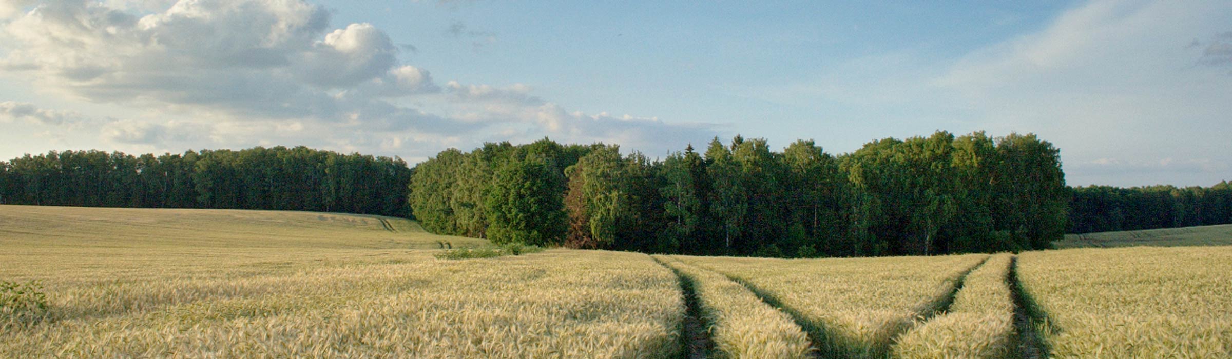
The Factory Lake (Tylickie, Przybocz)
The lake is located at the eastern border of the commune.. Area: 35 ha, maximum length: 1600 m, maximum width: 320 m, water level at the height of 97.8 m above sea level. Powered by a branch of the Wel River, known as the Bałwanka. It flows into the lake from the south through wet meadows and rushes surrounded by forest. The forest overgrows the north-eastern shore of the elongated lake, while the high slope on the south-west side is only partially forested. Hardly noticeable outflow in the north-eastern corner of the lake flows after about 1.1 km into the old riverbed of the Wel River.
The Gryźliny Lake
The lake is located on the edge of the village. Area: 30.9 ha, maximum length approx. 1000 m, maximum width - approx. 430 m, average depth 3.2 m, maximum depth = 5.6 m, water surface at the height of 93.9 m. Some of the water flows eastwards to the Radomno stream (during higher water levels), some through the narrow flow flows to Lake Studa. There are bream, roach, eel, pike in the lake. Lake Gryźliny may be the beginning of the canoe trail Struga Kakaj (however, you need to carry or transport kayaks).
The Górne Lake
The lake is located in the eastern part of the commune. Area 7.5 ha, maximum length 570 m, maximum width 190 m, water level at the height of 98.1 m a.s.l. The lake is located northeast of the Central Lake (Tylickie Małe), separated from it by a dike of the former Nowe Miasto Lubawskie - Lubawa railway line. High steep slopes on the lake from the south-west side are overgrown with forest, areas from the north-east are devoid of forest.
The Lekarty Lake
The lake is a glacial lake, gutter lake. The commune border runs along the eastern shore of the lake (the lake's surface is in the Biskupiec commune). Area: 46 ha, maximum length - approx. 1520 m, maximum width - approx. 430 m. The lake is surrounded by forest from the west, steep gutter visible from the east, wooded in the northern part, discovered in the southern part. In the southern part of the lake there is a visible narrowing with a small bay, sometimes treated as a separate lake Moszyska or Mościska. The lake has got roach, perch, eel, carp, pike and tench. There is poor flow from Studa lake from the north.
The Radomno Lake
The Radomno lake is a glacial, highly fragmented lake, located in the northern part of the commune. Area: 98.8 ha, maximum length: 2350 m, maximum width: 1100 m, average depth: 2.5 m, maximum depth: 16.2 m. The water surface is located at an altitude of approx. 89.7 m. High in the northern part of the lake (111 m a.s.l. and 21 m above the lake surface) is wooded island. The lake consists of three elongated bays. In the south, a narrow bay, 600 m long, squeezes between the buildings of the village of Radomno. In the northern part there is a wide peninsula on which the settlement is Nowy Ostrów. It divides the lake into two parts. To the north-east (60-260 m) and the winding bay stretches for about 1900 m. West of the peninsula there is a large wider bay (1400 to 800 m), with an island in the middle. On the island there are remains of a former stronghold. The lake is connected in the north through Struga (Struga Radomno, Ruda) with the lakes Łąckie and Czerwone and drained through the same river in a southern direction to Drwęca. Struga creates a short, but picturesque canoe trail. There is a legend associated with Radomno Lake: Near the village there was a battle between Prussian troops and Napoleon's soldiers.
The Skarlin Lake
The Skarlin lake is the largest in the commune. Postglacial, very elongated shape, located in a gutter with a parallel path. Area 293.8 ha, maximum length 6515 m, maximum width 650 m, average depth 7.5 m, maximum depth 15.1 m. Water mirror at an altitude of approx. 86.6 m a.s.l. The lake is drained by Skarlanka, which flows into the lake at its western end. The uncovered surface of the lake, devoid of natural forest cover, creates perfect conditions for windsurfing enthusiasts. The lake is often visited by fishermen, most often they catch roach, bream, as well as whitefish and eels.
The Studa Lake
The lake is located at the western edge of the commune. Area 33.5 ha, maximum length approx. 1330 m, maximum width approx. 440m, average depth 1.9 m, maximum depth 3.6 m. Water mirror at a height of approx. 92.7 m a.s.l. The lake is located among fields, in the extension of the latitudinal gutter of Gryźliny Lake, about 1.4 km west of the village from Gryźliny.
The Central Lake (Tylickie Małe)
The lakie is situated in the east of the commune. Area: 13.5 ha, maximum length: 700 m, maximum width: 280 m, water surface at the height of 97.8 m. In the north-east, the dyke of the closed railway line Nowe Miasto Lubawskie - Lubawa separates them from the nearby Fabryczny Lake. The high, steep slopes of the lake on the west side are covered by the forest, slopes on the north-east side are uncovered. In the southern part, the lake shores are clearly lowering.
The Wieczorki Lake
The Lake is located on the edge of the village of Skarlin. Area 8 ha, maximum length about 780 m, maximum width about 190 m, water surface at the height of about 100.9 m a.s.l. The lake is located among fields.